


It’s been a summer of farmers working backward, in order to go forward in parts of storm-ravaged Nebraska and South Dakota.

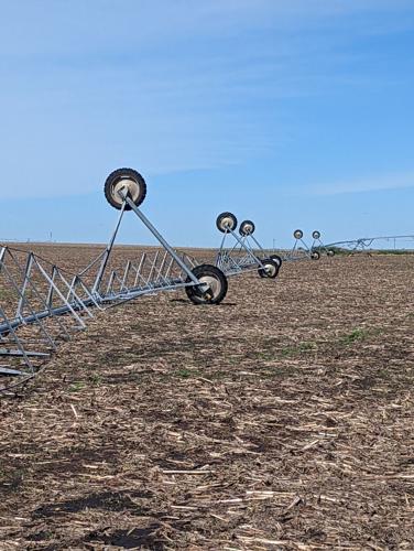
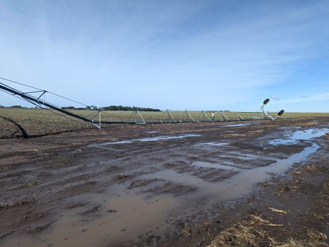
Irrigation pivots sustained storm damage in Clay County, Nebraska June 7.

"If there was a tractor working in the field we would know within seconds if it was red, green, blue or orange and if it was cultivating or perhaps baling hay. Yes, this farmer’s grandson knows his farming terms quite well."

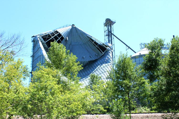
A grain bin on the edge of Beaver Creek, Minn., is damaged from spring storms.

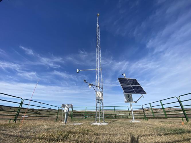
The newest generation Mesonet station is like this one near Oacoma, S.D.
People are also reading…

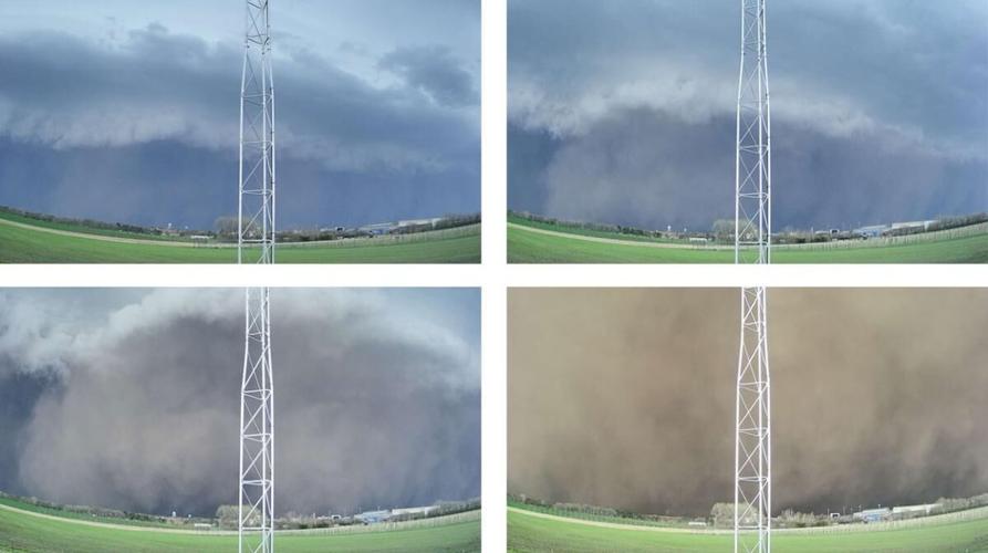
A photo sequence from May 12 shows the derecho approaching Beresford, S.D., as the intense squall line of severe storms whips up dust.

It started off as a beautiful, sunny day in northeastern South Dakota.

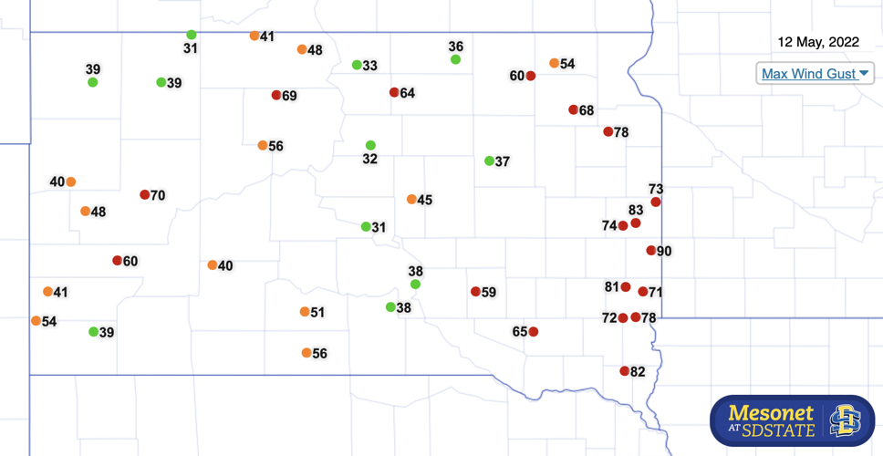
This map shows the maximum wind gusts recorded May 12 in South Dakota with fierce winds indicated in the southeastern part of the state produced by a derecho.
Reporter Amy Hadachek is a two-time Emmy Award winning meteorologist and a storm chaser who earned her NWA and AMS Broadcast Meteorology Seals of Approval. She and her husband live on a diversified farm in Kansas. Reach her at amy.hadachek@midwestmessenger.com.


