


Potholes everywhere. Roundabouts on a truck route. Speed limits too slow. Not enough gravel on the road. Too much gravel on the road.

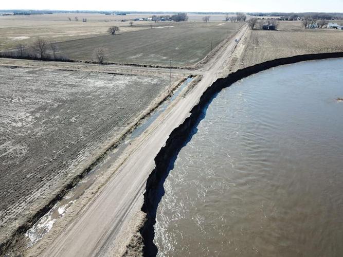
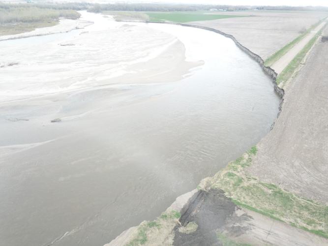
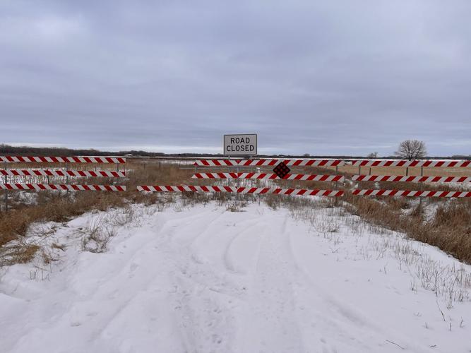
By April 27, 2019, the road known as Old Highway 8 was completely impassable. Acres of farm land were lost as the river’s bend swelled southward.

Because the gravel road is completely gone, residents on the west side of the river do not have access to Norfolk without driving around the section.
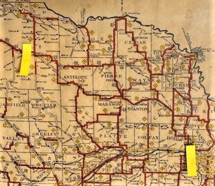
Old Highway 8 snaked through northeastern Nebraska from Fremont to O’Neill, as tracked on this map dated July 1, 1930. The map is owned by Bob Carstens, resident of Madison, Neb.

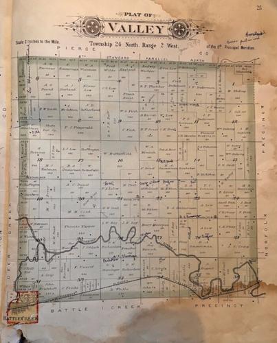
The plat map of Valley Precinct in Madison County shows the course of the Elkhorn River in 1899.

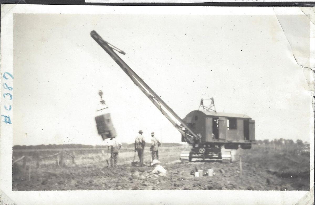
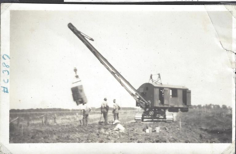
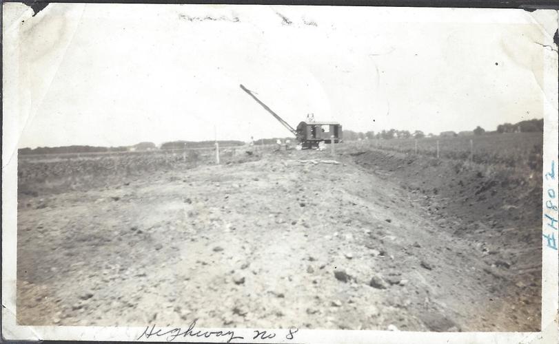
Built during the Great Depression Era, Old Highway 8 provided jobs to the construction workers who cleared trees and raised up the road. Thousands of yards of dirt were moved in with horse and wagon.
People are also reading…

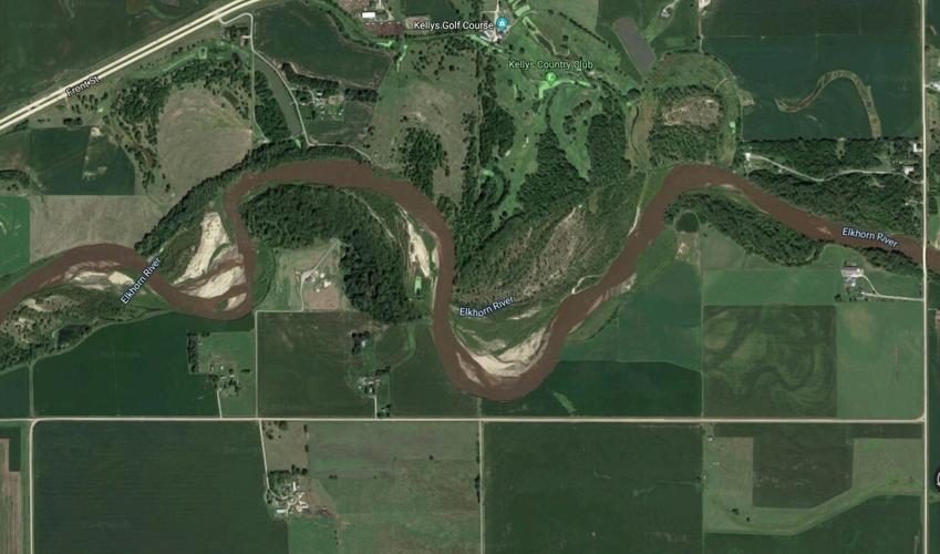
On this image from Google Earth, the Elkhorn River inched ever closer to Old Highway 8. The imagery date is August 22, 2017.

Chunks of Old Highway 8 fall into the Elkhorn River after flooding in March of 2019.
Reporter Kristen Sindelar has loved agriculture her entire life, coming from a diversified farm with three generations working side-by-side in northeastern Nebraska. Reach her at Kristen.Sindelar@midwestmessenger.com.

Kristen Sindelar
Agriculture Reporter


