


The changing climate has sparked more violent storms and is impacting grain and livestock production worldwide.
Sunny. Hot and humid. High 96F. Winds SSW at 10 to 15 mph.
Clear skies. Low 74F. Winds S at 5 to 10 mph.
Sunny skies. Hot and humid. High 94F. Winds SSW at 10 to 15 mph.
...EXTREME HEAT WARNING IN EFFECT UNTIL 10 PM CDT FRIDAY...

* WHAT...Dangerously hot conditions with heat index values up to 107.

* WHERE...Portions of south central, southwest, and west central
Illinois and central, east central, northeast, and southeast
Missouri.

* WHEN...Until 10 PM CDT Friday.

* IMPACTS...Heat related illnesses increase significantly during
extreme heat and high humidity events.

PRECAUTIONARY/PREPAREDNESS ACTIONS...

Drink plenty of fluids, stay in an air-conditioned room, stay out of
the sun, and check up on relatives and neighbors. Young children and
pets should never be left unattended in vehicles under any
circumstances. Take extra precautions if you work or spend time
outside. When possible reschedule strenuous activities to early
morning or evening. Know the signs and symptoms of heat exhaustion
and heat stroke. Wear lightweight and loose fitting clothing when
possible. To reduce risk during outdoor work, the Occupational Safety
and Health Administration recommends scheduling frequent rest breaks
in shaded or air conditioned environments. Anyone overcome by heat
should be moved to a cool and shaded location. Heat stroke is an
emergency! Call 9 1 1.

&&
Wind: SSW @ 11 mph
Precip: 0% Chance
Humidity: 48%
Wind Chill: 93°
Heat Index: 101°
UV Index: 9 Very High
Visibility: 10 mi
Dew Point: 70°
Wind: SSW @ 11 mph
Precip: 0% Chance
Humidity: 44%
Wind Chill: 94°
Heat Index: 102°
UV Index: 9 Very High
Visibility: 9 mi
Dew Point: 69°
Wind: SSW @ 11 mph
Precip: 0% Chance
Humidity: 43%
Wind Chill: 95°
Heat Index: 102°
UV Index: 8 Very High
Visibility: 9 mi
Dew Point: 69°
Wind: SSW @ 12 mph
Precip: 0% Chance
Humidity: 42%
Wind Chill: 95°
Heat Index: 101°
UV Index: 5 Moderate
Visibility: 9 mi
Dew Point: 68°
Wind: SSW @ 12 mph
Precip: 0% Chance
Humidity: 43%
Wind Chill: 94°
Heat Index: 101°
UV Index: 3 Moderate
Visibility: 9 mi
Dew Point: 68°
Wind: SSW @ 10 mph
Precip: 0% Chance
Humidity: 45%
Wind Chill: 93°
Heat Index: 100°
UV Index: 2 Low
Visibility: 10 mi
Dew Point: 69°
Wind: S @ 8 mph
Precip: 1% Chance
Humidity: 51%
Wind Chill: 92°
Heat Index: 100°
UV Index: 0 Low
Visibility: 10 mi
Dew Point: 71°
Wind: S @ 7 mph
Precip: 2% Chance
Humidity: 56%
Wind Chill: 90°
Heat Index: 98°
UV Index: 0 Low
Visibility: 9 mi
Dew Point: 72°
Wind: SSE @ 6 mph
Precip: 2% Chance
Humidity: 63%
Wind Chill: 86°
Heat Index: 94°
UV Index: 0 Low
Visibility: 10 mi
Dew Point: 72°
Wind: SSE @ 6 mph
Precip: 3% Chance
Humidity: 68%
Wind Chill: 85°
Heat Index: 92°
UV Index: 0 Low
Visibility: 10 mi
Dew Point: 73°
Wind: S @ 5 mph
Precip: 3% Chance
Humidity: 71%
Wind Chill: 83°
Heat Index: 90°
UV Index: 0 Low
Visibility: 10 mi
Dew Point: 73°
Wind: S @ 6 mph
Precip: 3% Chance
Humidity: 74%
Wind Chill: 82°
Heat Index: 88°
UV Index: 0 Low
Visibility: 10 mi
Dew Point: 73°
The changing climate has sparked more violent storms and is impacting grain and livestock production worldwide.

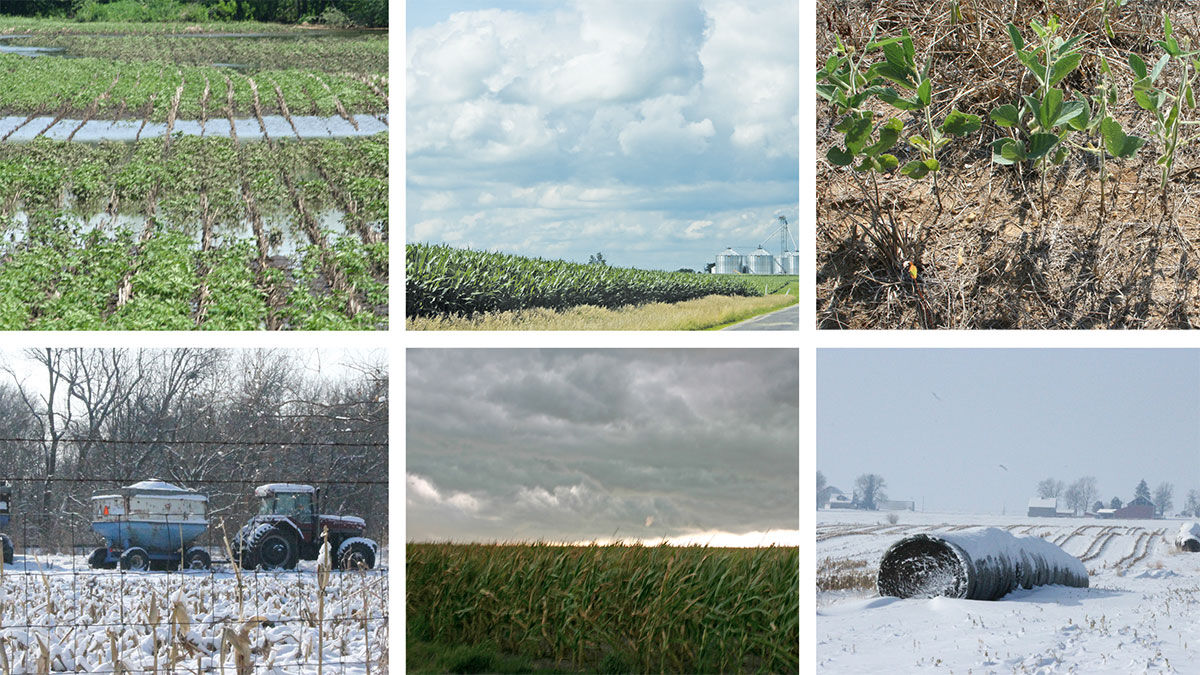
Extreme weather patterns have created some challenging conditions for farmers over the last several years, and some industry experts believe they may lead to long-term implications for costs like inputs and insurance.

High winds June 29 caused damage to this corn field near Silver City in southwest Iowa. Gov. Kim Reynolds issued disaster proclamations for southern Iowa counties ravaged by storms starting June 29. The actions cover three southeast Iowa counties — Jefferson, Lee and Wapello — plus Ringgold …

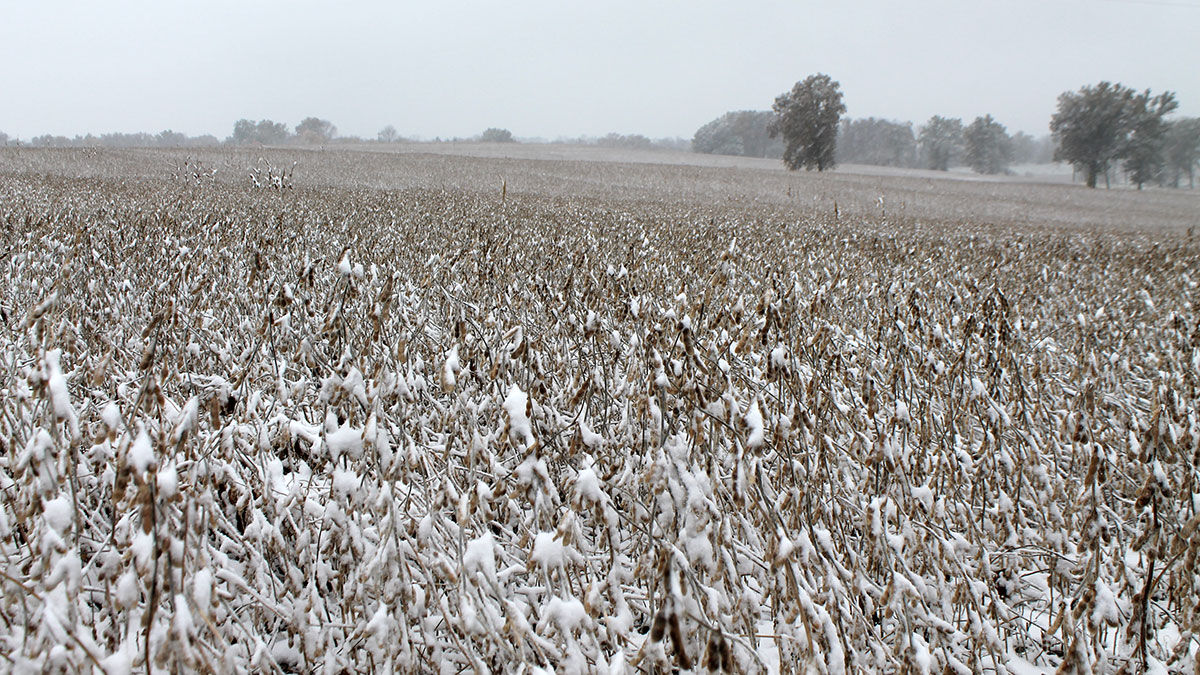
During the first few days of May, heavy precipitation was scarce and mostly limited to the upper Great Lakes region and the Northeast. However, portions of the upper Great Lakes States received heavy snow, while some Northeastern locations received rainfall totaling at least 2 to 4 inches Ap…

The last in a series of winter-like storms punched inland across the West before crossing the central Plains and upper Midwest during the week of April 2-8, according to the April 11 USDA Weekly Weather and Crop Bulletin.

A move away from La Niña conditions in the Pacific Ocean, replaced by either neutral conditions or a move toward El Niño, could result in favorable summer weather for growing crops, University of Missouri atmospheric sciences professor Tony Lupo says.

The past three years have been dominated by a La Niña weather pattern, but models are showing that may finally be coming to an end.

A pair of late-December storm systems moved ashore in the West, delivering heavy precipitation in the Pacific Coast States and significant snow from the Cascades and Sierra Nevada to the western slopes of the Rockies during the week of Dec. 25-31, according to the Jan. 3 USDA Weekly Weather …

During the second half of the week of Nov. 20-26, wet weather across the South replaced previously tranquil conditions, although some heavy rain had fallen earlier in the western Gulf Coast region and across southern Florida, according to the Nov. 29 USDA Weekly Weather and Crop Bulletin.
Cold, dry weather prevailed nearly coast to coast during the week of Nov. 13-19, according to the Nov. 22 USDA Weekly Weather and Crop Bulletin. Notably, snow squalls developed downwind of the Great Lakes, resulting in localized totals of 2 to 6 feet or more. In addition, precipitation fell …
URBANA, Ill. — Changing weather patterns have profound impacts on agricultural production around the world. Higher temperatures, severe drought and other weather events may decrease output in some regions, but effects are often volatile and unpredictable.

From Oct. 30 through Nov. 5, for the second week in a row, rain provided drought relief from the western Gulf Coast region and lower Mississippi Valley into the Great Lakes States, according to the Nov. 8 USDA Weekly Weather and Crop Bulletin.
Dry weather continued to dominate many parts of the country the week of Oct. 23-29, allowing a rapid harvest pace to proceed for a variety of crops, according to the Nov. 1 USDA Weekly Weather and Crop Bulletin. Little or no precipitation fell across large sections of the East, High Plains, …


Recently Listed
Get up-to-the-minute news sent straight to your device.